

Watching Greenland Melt : A Well Thought Out Scream by James Riordan
So you all know that Greenland isn’t green, right? The story goes that once upon a time, war broke out among Norwegian Vikings. One band launched the boats and fled. They discovered a green island and settled. Afraid that their enemies might pursue them, they sent word back to Norway that their island was actually an ice-land, but that another island — more distant, larger and indeed covered by ice — was inhabitable green-land. And so the green island became Iceland, and the icy island became Greenland. It’s a cool story, but it’s false. The true story of Iceland’s founding is more complicated and had something to do with Ingolfur Arnason, a Norse chieftain who founded Reykjavik in 874. Greenland, meanwhile, was not “discovered” (by Norsemen, that is) until a century or so later, when a Norwegian who was sailing to Iceland was blown off course. It was later named “green land” by Erik the Red, another Norwegian, who really was fleeing from Norway and first went to Iceland before settling in Greenland. He wanted to bring more settlers and was obviously good at branding and marketing — “green jobs” for his “green economy”, if you will.
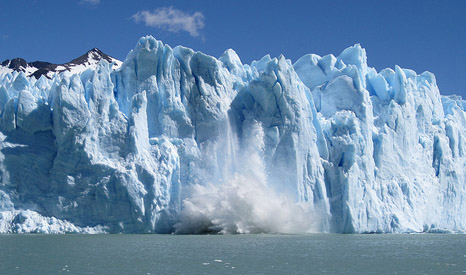
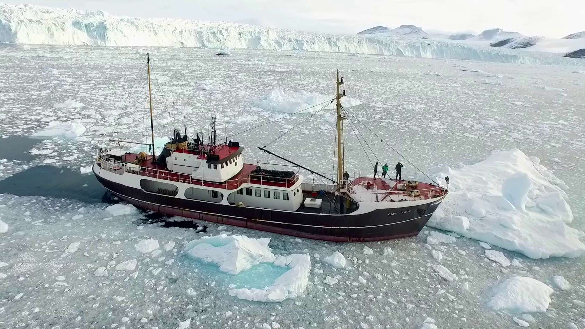 Greenland is the largest island in the world. Australia is bigger but it is considered a continent (technically, all continents could be called islands as they are surrounded by water). But the largest island in the world is shrinking and some people would say it’s happening way too fast. Back in 2015, in a moment of science communication genius, NASA created a mission called “OMG.” The acronym basically ensured that a new scientific mission — measuring how quickly the Oceans are Melting Greenland — would get maximum press attention. The subject is actually extremely serious. OMG amounts to a comprehensive attempt, using ships, planes, and other research tools, to understand what’s happening as warm seas creep into large numbers of fjords that serve as avenues into the vast ice sheet — many of which contain large and partly submerged glaciers that are already melting and contributing to sea-level rise.
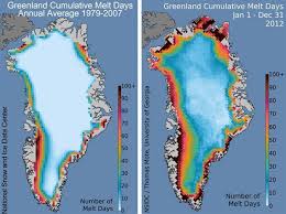
Greenland is, in fact, the largest global contributor to rising seas — adding around a millimeter per year to the global ocean, NASA says — and it has 7.36 potential meters (over 24 feet) to give. The question is how fast it could lose that ice, and over five years, OMG plans to pull in enough data to give the best answer yet. “We’ve never observed Greenland disappearing before, and that’s what OMG is about,” says Josh Willis, a researcher at NASA’s Jet Propulsion Laboratory who is the principal investigator on the mission. “We want to watch how it shrinks over the next five years, and see how we can use that information to better predict the future.”
 And now, the first data are coming in, in the form of not one but two new studies published in the journal Oceanography by NASA scientists and affiliated university researchers, seeking to measure the swirl of oceans around Greenland and in particular how a warm, deep layer of Atlantic-originating water is moving and interacting with its glaciers. Basically, it works like this: Waters swirl in a broadly clockwise rotation around the enormous island (see below), often darting inward toward the outlying glaciers along the way. And in fjords that are the deepest, the Atlantic layer, which tends to be over 200 meters (more than 650 feet) deep, has the greatest chance of causing sustained melting. “Where it’s deep, there’s warm water,” says Willis. Above the Atlantic layer, meanwhile, is a layer of colder polar water that has far less of an effect on glaciers — meaning that the big and thick glaciers often get hit hard at their bases, even as the small and thin ones don’t necessarily get hit much at all.
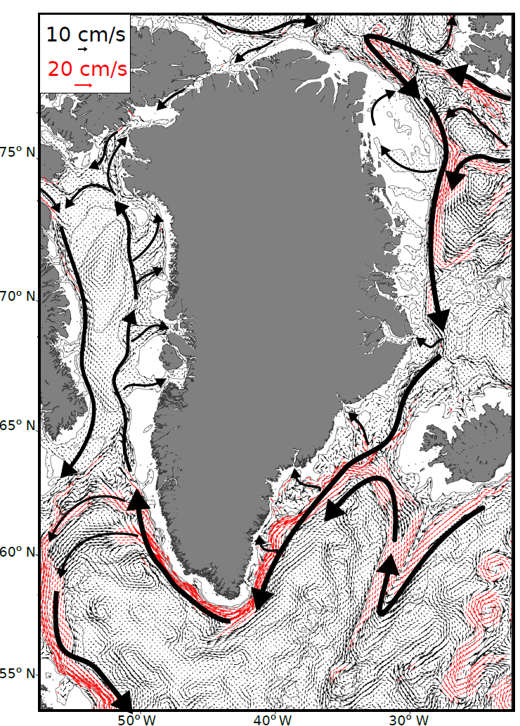
Here’s a figure that the scientists have produced, showing the overall flow of waters around the ice island: © NASA/JPL-Caltech
The newly published research does not present any answer — yet — to the big question animating all of this: How fast will Greenland melt and raise seas in a way that threatens, say, Florida?
In order to answer this key question, the researchers need comprehensive data on the depths and shape of the fjords, the thickness of the glaciers, and the behavior of the oceans around a Greenland coastline that, NASA notes, is 27,000 miles in length. Then, they will need to feed all of that information into a computer simulation that projects climate change forward to 2100 and calculates the consequences, at a high resolution, for Greenland’s icy coasts.
“It’s too early” to run the model, said Mathieu Morlighem, a researcher at the University of California, Irvine and the lead author of one of the papers presenting the accumulating data. “I think you need to wait another year or two, maybe more. It was not possible at all before OMG.”
Still, the recently published findings mark a start. Morlighem’s study, for instance, looked at the depth and shape of the seafloor near the fronts of and beneath numerous Greenland glaciers. The research shows that numerous glaciers extend deeper beneath the surface of the ocean than previously thought.
For instance, Store Glacier in northwestern Greenland (at around 70 degrees North latitude in the image above) starts at 400 meters (around 1,300 feet) deep where its front touches the ocean, and then plunges to depths as high as 1,000 meters deep (3,280 feet) farther inland — making it quite vulnerable to the ocean. Prior research, however, had suggested the glacier was much shallower. The same was true of numerous other glaciers, which also appear more vulnerable than previously thought.
 “OMG is transforming our knowledge of which glaciers are vulnerable to more warming or not,” Morlighem said. “So I wouldn’t say we have been surprised, it’s more, we had no idea, for many of these fjords, what they were looking like.” Overall, the data are also showing that Greenland’s west coast is far more vulnerable, in general, than its east, Morlighem said.
The second study, meanwhile, examines at ocean circulation around the Greenland coast and finds, strikingly, that between 68 degrees North latitude along the coast and 77 degrees North (see above), the deepest warm layer of Atlantic water cools from 3.5 degrees Celsius down to 2.5 degrees Celsius. Moreover, it does so in part because the water busily melts away at a large and deep glacier called Upernavik at 73 degrees North, which touches the ocean in 675 meter (over 2,000 foot) deep waters. The cold meltwater from the glacier spills into the ocean and, through mixing, cools the warm Atlantic water somewhat.
“The glaciers there are actively losing enough ice, and enough fresh water, that it’s important for the oceanography, and how the water changes as it goes up the west coast of Greenland,” says Willis. That in itself is proof that Greenland is melting quite a lot.
The big picture is that NASA’s new data suggest — that’s right — new vulnerabilities.
“Overall, together I think these papers suggest that the glaciers as a whole are more vulnerable than we thought they were,” Willis said. He says that, of course, with the aforementioned caveat that NASA’s not ready yet to feed the data into a model that actually shows how this could play out over the decades of our future.
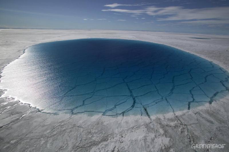
Greenpeace crewmembers help scientists to take depth soundings from the bottom of ‘melt-lakes’ 4.5 Miles South of Swiss Camp, inland from Disko Bay in West Greenland. Two lakes were sounded, 2.5miles apart, the coordinates for these were. Lake 1 69¼32m N 49¼07m W
Lake 2 69¼29m N 49¼12m W
Greenpeace and an independent NASA-funded scientist completed measurements of melt lakes
on the Greenland Ice Sheet that show its vulnerability to warming temperatures.The measurements are the last scheduled activity as the Greenpeace ship Arctic Sunrise wraps up its two-month expedition to document the impacts of climate change on Greenland’s ice sheet and
glaciers.
©Greenpeace/ Nick Cobbing.
GREENPEACE HANDOUT – NO ARCHIVE – NO RESALE – OK FOR ONLINE REPRO
For now, we’re still stuck with official estimates from bodies like the United Nations Intergovernmental Panel on Climate Change, which said in 2013 that Greenland’s melting might at most contribute 21 centimeters to sea-level rise by 2100, with some possible addition from rapid ice collapse (this is the high-end number for what scientists call the “likely” range in a worst-case global warming scenario, to be precise). But missions like OMG, in the meantime, are giving us plenty to worry about.
“These kinds of results suggest that we could be in for more sea level rise than we thought,” Willis said. “And we’re not alone, the fact is that almost every time some new results come out of Greenland or Antarctica, we find these glaciers are more vulnerable than we thought.”
Pictured to the left is a huge lake of melt water on top of a Greenland Glacier. The melting glaciers are fuelling sea level rise.
Melting Greenland fuels sea level rise | Greenpeace International
Greenpeace800 × 532Search by image

No Comment